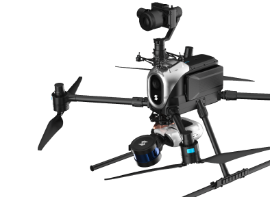
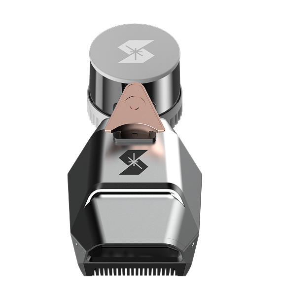
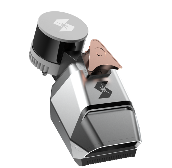
SIRIUS Original Module
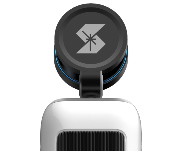
Rotary LiDAR-based
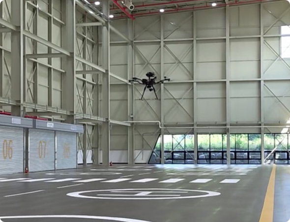
Autonomous Robot Operation
Module
- What is a Module?
- A product that, when installed on a drone or robot, creates a virtual space and generates an autonomous driving path through high-performance LiDAR and 3D mapping.
Core Solution Process
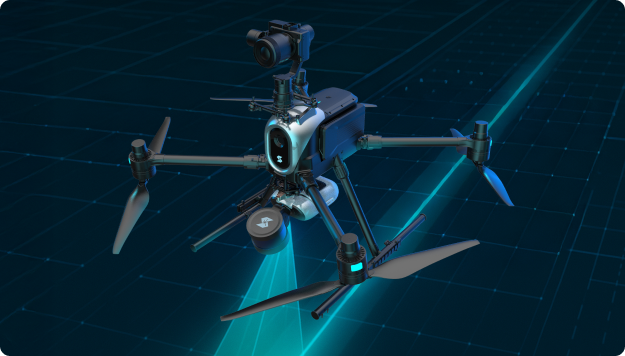
Autonomous Driving
Simultaneous 3D Control and Management of SLAM, Path Planning, and Collision Avoidance
- Cost Reduction Through Optimization of Operating Personnel
- Over 50% improvement in operational efficiency. An unmanned automatic inspection system enables integrated operation of multiple drones and robots.
- Increased Inspection Success Rate
- Drone automation achieves 100% collision avoidance performance for both drones and ground robots.
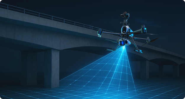
Inspection Automation
AI, automatic POI (Point of Interest) generation technology, and surveying allow for the inspection of facilities within a designated range.
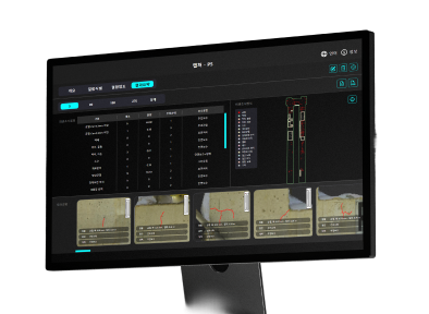
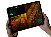
- Remote Automatic Control Without the Need for Experts
- A web-based, real-time drone control system provides an operation environment free from geographical constraints.
- Integrated management of inspection sites anytime, anywhere.
- An effective management system for the entire site based on a 3D digital twin.
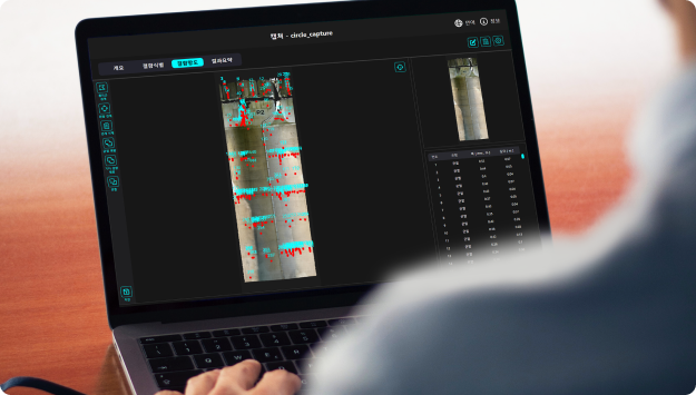
Automatic Manage and Analysis
Inspection automation technology enables fast and accurate inspections of target facilities.
- All-in-One Automation of the Entire Analysis Process
- Maximized efficiency through all-in-one automation of the entire process, from AI-based external survey mapping to facility diagnosis report generation and grade evaluation.
- Precise damage verification with a dataset of 200,000 images.
- ※ Crack Detection Accuracy (mloU) = 0.847
※ Efflorescence Detection Accuracy (mAP) : 0.94 (World-class level, certified by a public institution)
Various Usability

Building Exterior Walls
Safely inspect high-rise building exterior walls that are difficult for people to climb.
Interlocking Package
Inside of a facility
Key to convenient digital inspection.
Interlocking Package


Bridge
Safely inspect dangerous areas, even under bridges.
Interlocking Package
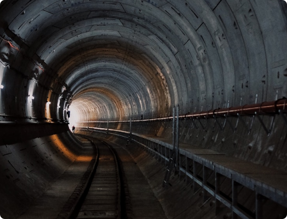
Tunnel
Smartly inspect dark tunnel interiors and areas where vision is limited.
Interlocking Package
Product Info
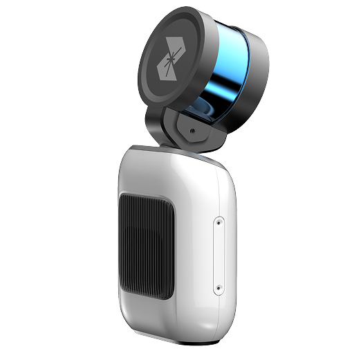
Module 1
Basic info

Weight2.2kg

Spacein/outdoor

NetworkLTE
Size130 x 145 x 324mm

Voltage24V/10A
-
Operating Temperature
0℃ - 50℃
-
Compatibility
PX4 / Sirius Wing
-
Mounting and Application
MethodsDrone, Ground Robot, Handy, Fixed

Lidar and Scanning
-
Mapping Method
Rotary LiDAR SLAM
-
Maximum
Detection Range100m
-
FOV
360 x 280

Autonomous
-
Collision Avoidance
Available
-
Collision
PreventionAvailable
-
Landing Error
Under 0.5m


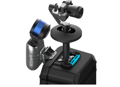
Camera/Gimbal (Optional 01)
-
Camera
SONY ILX-LR
-
Lens
35 mm / 55 mm
-
Resolution
64 MP (Full Frame)
-
Gimbal and
Camera ControlAvailable
-
Sensor size
230x155x175 mm³
(Camera and lens mounting criteria)
Camera/Gimbal (Optional 02)
-
Camera
RIEBO SF6
-
Number of valid
pixelsApproximately 61 million pixels (9,504 x 6,336 pixels) or more
-
Sensor Type
35mm full frame
-
Shutter speed
1/100 ~ 1/2,000 s
-
ISO
100-6,400 or more
-
FOV
35° (H) x 24° (V) or more
-
Light interlocking
Available
-
Light power
Lighting power supply by external power source (battery, etc.)
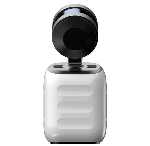
Module 2
Basic info
Weight1.67kg
Spacein/outdoor
NetworkLTE
Size300 x 132 x 150 mm
Voltage24V/10A
-
Operating Temperature
-45℃ - 80℃
-
Compatibility
PX4 / SIRIUS Wing / SIRIUS Wearable
-
Mounting and Application
MethodsDrone / Ground robot / Wearable
Lidar and Scanning
-
Mapping Method
Rotary LiDAR SLAM
-
Maximum
Detection Range300 m
-
FOV
360 x 40.3
Autonomous
-
Collision Avoidance
Available (Automatic mode of operation)
-
Collision
PreventionAvailable (Manual mode of operation)
-
Landing Error
Under 0.5m
Camera/Gimbal (Optional 01)
-
Camera
SONY ILX-LR
-
Lens
35 mm / 55 mm
-
Resolution
64 MP (Full Frame)
-
Gimbal and
Camera ControlAvailable
-
Sensor size
230x155x175 mm³
(Camera and lens mounting criteria)
Camera/Gimbal (Optional 02)
-
Camera
RIEBO SF6
-
Number of valid
pixelsApproximately 61 million pixels (9,504 x 6,336 pixels) or more
-
Sensor Type
35mm Full frame
-
Shutter speed
1/100 ~ 1/2,000 s
-
ISO
100-6,400 or more
-
FOV
35° (H) x 24° (V) or more
-
Light interlocking
Available
-
Light power
Lighting power supply by external power source (battery, etc.)